Waking up in Lake Tahoe we knew we had a long road ahead of us. We had done some planning as Julie wanted to do something special for her birthday which was happening in about a week and a half. Julie has a large part of her family in the Indianapolis, IN area and her parents wanted to meet up with us on the trip as well. Julie thought it would be fun to do an impromptu Indiana family reunion which could overlap with her birthday. As we had seen most of the western states at this point, we wanted to scoot over and check out Nebraska and Iowa, which we had somehow skipped in the last 3 years. As this was the case, we had a “short” 1,102 miles to go from our campsite at Zephyr Cove, NV to Scottsbluff, NE; our first stop in Nebraska.
Driving from Lake Tahoe the rain was hitting hard as we drove over the crest of the mountain that the lake was in. From here you could see for miles, to Carson City and beyond. The road twisted and turned, back and forth until we had dropped a few thousand feet and entered the outskirts of Nevada’s capitol city. We then merged onto I-580 to Reno and finally onto I-80 and started our trip east.
The Great North-Central Nevada Desert
Driving east on I-80 from Reno puts you smack dab in the middle of nowhere. This area is Nevada’s vast high desert. Yes, there are small towns that seem to be supported by a highway gas station but other than that the area is devoid of all human life. This in no way means that it’s a wasteland. I love desert scenery and north-central Nevada provides tons of this. We saw mountains in the distance, the occasional river and stream running next to the road as well as cactus and tumble weeds blowing around in the wind. One of the most fascinating (and partly sad) scenes are the abandoned buildings. We passed abandoned hotels, motels, houses and farms. There was the occasional vehicle that looked 40 years old just sitting on the side of an adjacent road, no one for miles around.
As we drove, we looked up the history of the towns that we passed. Some started as gold rush towns or towns to support a nearby gold rush mine. Others were railroad depots, towns specifically set up so that the railroad could continue on to the next town over. It was all pretty fascinating especially when we really didn’t see any reason in particular for a town to exist at all. Eventually we reached the eastern Nevada border and headed into Utah.
The Bonneville Salt Flats & The Traveling Moth
Shortly crossing the border into Utah, we drove through the famous Bonneville Salt Flats. This is one of the very few spots in the world where it is so flat the fastest cars and vehicles on wheels are brought here to break land speed records. Driving across it on the highway it looked almost like an alien landscape. If you think nothing is going on in the regular desert, then you haven’t seen the salt flats before.
We had thought about stopping for the night in the last town that we passed in Nevada but had thought that we would push forward and stop in Salt Lake City for the night. We don’t generally drive the van at night and as we found out, if you stop driving at night you lose that skill pretty fast. We wanted to get east though so we pressed on. Night fell soon after going east of the salt flats. We were just about an hour from Salt Lake City when a thunderstorm descended upon us. Julie was driving and within minutes it had started torrential raining with thunder and lightning. This is when the moth made his appearance. Each time a bolt of lightning struck, the entire van was lit up and a huge moth was at one end of the windshield. 30 seconds later another bolt of lightning and the moth had moved again. In Julie’s mind in the darkness between lightning bolts I’m sure she heard evil music from a horror movie, not knowing where the moth would show up next. Even though we had been living outside for 4+ months at this point bugs were still not Julie’s favorite, especially large moths as she drove the van down the highway at night in the rain. While she did scream a bit when she could see the moth, but she kept the van straight on the road and after the 4th or 5th flash of light I was able to finally smash the moth, and everything was well once again in the van. 45 minutes later we pulled into the Salt Lake City KOA, set up camp for the night and caught our breaths. That was a long drive.
Utah’s Rocky Mountains
The next morning, we woke up and after gassing up the van merged once again onto I-80 east. We had partially done this drive 2 years prior when we visited friends who were on a work trip in Park City, UT. The first half hour of the drive we recognized a few things from before but after we passed Park City it was all new to us.
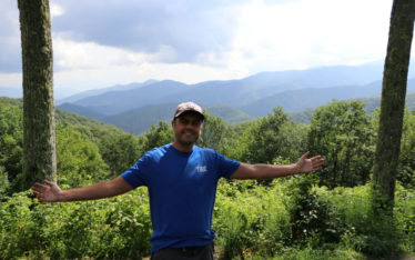
Utah is one of our favorite states. This is because it has so much varied natural beauty. Driving from the desert in Salt Lake City up into the Rocky Mountains the scenery does a 180. It goes from small squat sage brush and cactus to tall alpine pine trees with blue green rivers and lush mountain valleys. We passed mountain ski towns and surprisingly enough mountain farming towns. The highway in the part of Utah twisted and turned around the huge Rocky Mountains. As we got closer to the Wyoming border the scenery once again changed from alpine greens back into a high desert landscape.
Evanston, Wyoming & The Jamaican Bobsled Team
Soon enough we entered into the southwestern corner of Wyoming. As it was getting to be close to lunch, we stopped at the first town that we came to; Evanston. After eating lunch in the van, we set out to explore the little town. Evanston it turned out started as a railroad town then a major stopping point on the Lincoln Highway (now I-80). What its most famous for today is oddly enough the Jamaican Bobsled Team.
We were walking around the town when I noticed a law firms office. Attached to the law firms sign was a small sign that said, “Jamaican Bobsleigh Federation”. I really had no idea what to make of this. Why would the Jamaican Bobsled Team or Jamaican anything have an office in this tiny town in southwestern Wyoming? After a quick question to Google I found out why. In 1997 a lawyer by the name of Paul Skog wanted to do something for his community. The bobsled track had been recently built in Park City, UT for the upcoming 2002 Salt Lake City Olympics. He called down to Jamaica to ask if 1. They still had a team and 2. If they would be willing to come to Evanston to train for free? The team said yes, flew up to Wyoming and trained there for the 2002 Olympics and again for the 2014 Olympics. It’s a pretty heartwarming story to say the least. You can read all about it in an article from 2014, here. From Evanston we continued across the state of Wyoming making it a little more than halfway before calling it a day and pulling into a campground for the night.
Laramie, Wyoming
The next morning, we woke up and continued our way through Wyoming on I-80. Towards the late morning we needed a grocery stop so we stopped at Wyoming’s largest college town, Laramie – home to the University of Wyoming. Even with school being out for the summer, Laramie was still a bustling town. Julie and I parked and started to walk around. As I’ve said before in previous blogs, I am not a fan of the old western tourist towns that keep everything looking like the late 1800’s just for the sake of the tourist dollar. Laramie was not like this. The buildings sure had a western feel to them but with all modern insides and the normal stores that you would see in any town. Banks, barber shops, restaurants, bars, breweries and outdoor stores; it was really quite nice. Julie and I walked around for a while popping into a few stores before settling in at the local brewery, Bond’s Brewing for a beer. We didn’t know what to expect with the town when we pulled in but, we ended up really enjoying ourselves there.
After leaving Laramie we jumped off of I-80 for the first time in 950 miles and headed on back roads to the town of Scottsbluff in western Nebraska. It was a beautiful day as we crossed into Nebraska. We pulled over and took a picture with the Welcome to Nebraska sign. The sign also told us that it was the home of arbor day, who knew! As we drove the last 40 minutes to Scottsbluff we felt as we had crossed some invisible boundary from the west to the Midwest. Gone for the most part were sagebrush and small cactus and, in its place, lush green fields and actual trees. We drove on to the small town of Gering where we would be spending the night. Even though the map didn’t show it, it felt like we were back in the east.
Scotts Bluff National Monument, Nebraska
The next morning we woke up ready for a shorter day of travels and one of a bit more exploring. After a quick breakfast we headed over to Scotts Bluff National Monument. Scotts Bluff is what it sounds like, a huge bluff in the middle of otherwise flat land named after a guy with the last name of Scott (all true). The bluff is famous as it was used as a landmark for the Oregon Trail, Mormon Trail, Pony Express and California Trail. We drove over to the bluff stopping in the information center where we learned more about the bluff and the surrounding area. We then hopped back into Bubbles and headed up.
A road had been built going up the bluff and Bubbles was just small enough for it (there were a few tunnels that were blasted out with height max of 11’, Bubbles being 9’9”). Once we reached the top we got out and walked around. The views were absolutely spectacular to say the least as the bluff is 800 feet tall. We walked a few of the short paths that were at the top of the monument before heading back down and walking among the Oregon Trail wagon exhibit before moving on for the day.
Our 2nd destination for the day was another Oregon Trail staple, Chimney Rock. Growing up and playing the computer game “Oregon Trail”, Chimney Rock was always a resting spot, so I was pretty excited to see the real thing. Unfortunately for us it did not turn out to be nearly as nice and definitely not as impressive as Scotts Bluff was.
Chimney Rock was about half an hour down a two-lane road from Scotts Bluff. While there was a visitors center you were not able to get close to the actual rock itself. If anyone has ever been to Mt. Rushmore expecting the faces to be huge, just to find out they are not as huge as you thought that they would be, that is how we felt about Chimney Rock. Chimney Rock turned out to be quite small. I’m sure it has eroded over the centuries, but it was just not quite what we expected. Julie and I skipped the visitors center and drove down a dirt road that looked like it had a small parking area at the end of it. While it did get us a little closer to the rock what we did find at the end of it was the Chimney Rock cemetery. We walked around seeing most gravestones from the late 1800’s and early 1900’s but some as recent as a few years prior. This was pretty neat to see.
From Chimney Rock we continued east in Nebraska eventually returning to I-80. We passed farm after farm of corn, soybeans and other heartland staple crops. Eventually we reached our destination campground between Nebraska’s two largest cities of Lincoln and Omaha.
Next up….Nebraska Cities! Lincoln & Omaha!