When we chose to go to Redding (or most cities that we travel to), we do not do much initial research before going. We look on a map and if the city is in an interesting natural area or in Redding’s case, the largest town in the area, we figure there has to be at least a few neat things to see so we check it out. The real reason we were in Redding however was poor planning. It was Labor Day weekend and while we wanted to spend it at Lake Tahoe, we didn’t plan ahead and after calling campground after campground we got nowhere. We then tried to stay at the campground or any campground around where we were near Mt. Lassen Volcanic National Park but no luck either. We then figured people would probably leave a city for long weekends…….bingo! We found a campground to stay at in Redding for the long weekend.
Redding, we found out is by no means a bad city. Saying that though as it sits in the Sacramento Valley and is nowhere as high in elevation as Mt. Lassen or Lake Tahoe, we found it gets hot around Labor Day; really hot. The highs for the few days that we were there were projected (and were) 101 to 105 degrees. After living in a van for the past 2 ½ years we knew we couldn’t control the weather, so we put on some of our lightest clothes and were ready to sweat it out.
Downtown Redding, CA
Day one we drove into downtown Redding and found a city that was trying to make a comeback. It had a few nice streets with some nice shops and restaurants but also had a lot of empty and dilapidated storefronts. After finding a nice street to park on we checked out a local gift store selling gifts, coffee and chocolate. We needed a few more DVD’s to watch so we found a used DVD/Music store called Bog Bean where we found some new shows to watch. (check out “Flight of the Conchords” if you can find it. It’s about two New Zealand musicians living in New York City trying to make it. Lots of dry humor and they incorporated their own songs in each episode. We loved it). At this point it was getting to be near lunchtime and we were getting a bit hungry. We decided to try some local food and found a great Mexican restaurant called La Cabana. It looked like they had taken over a small diner, changed around the décor and opened up. The food was simple but great. After lunch we were a bit thirsty and saw that there was a brewery in town called Cedar Crest Brewing. We walked over and shared a sampler of their beers. It was a pretty neat brewery and had some great beers!
Whiskeytown National Recreation Area
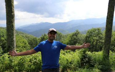
As it was mid-afternoon, and we thought that we had seen most of the city we looked on a map for other places to check out. What we found was Whiskeytown National Recreation Area. This area just to the northwest of Redding is over 200,000 acres with its crown jewel being the Whiskeytown Lake. After driving the short drive over to the lake, we stopped in at the visitor’s center which is run by the National Park Service. We had a lot of questions with the biggest one being “Why is it called Whiskeytown?” It turns out that Whiskeytown was a gold rush era mining town founded in 1849. The two theories about the naming of the town goes as follows; 1. A barrel of whisky that was on a mule fell over and broke into the small creek that flowed adjacent to the small town or 2. A miner could drink a barrel of whiskey per day. Whichever was the case the name stuck. Unfortunately for the town, it wasn’t meant to last forever as in 1960 a dam was built, and the valley flooded. Some of the town’s buildings were moved to higher ground but some still to this day are located deep under the water.
After learning about the town and the lake we headed out to explore for a bit. The first thing we noticed was how beautiful the lake was against a backdrop of arid mountains and pine trees. It looked like a sparkling blue oasis. The other thing that we noticed, almost immediately after was the unmistakable damage that a recent forest fire had caused. The Carr fire had happened the summer before and at its peak had engulfed 229,000 acres; killing 7 people, destroying over 1000 structures while decimating 97% of the recreation area. While the lake was beautiful it was still a bit eerie driving through this mostly charred black landscape looking at the lake knowing that this entire area was on fire just 12 months prior. We drove about halfway around the lake stopping at a few overlooks before we found a small beach where we put our feet in the water. As it was getting late in the afternoon we then hopped back into Bubbles and headed back to our campground for the night.
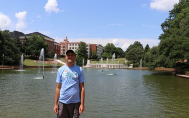
Redding’s Sundial Bridge
The next day after waking up and eating breakfast we wanted to go check out Redding’s most famous city sight, the Sundial Bridge. The bridge is located in the northeast section of the city in the Turtle Bay Exploration Park complex. This complex also houses environmental, art and history museums as well as the McConnell Abortorium and Gardens. We though were here for the bridge!
Opened in 2004, the pedestrian bridge spans 700 feet over the Sacramento River. It was designed by famed Spanish architect Santiago Calatrava and designed to look like (and be) a working sundial. The sundial support tower is 217 feet high pointing due north which casts a shadow on a large dial plate located on the north end of the bridge. On sunny days you can see the shadow from the sundial move about a foot per minute. The other unique feature about the bridge is that the deck of the bridge is made up using opaque glass which at night is illuminated in an aquamarine color giving it a very cool effect.
Julie and I found parking and headed over. Even though it was well over 100 degrees out people were everywhere. Apparently coming over to this park and checking out the bridge was a pretty popular thing to do on the weekend! We walked the bridge taking pictures and watching people float by in tubes and small boats down the river. When we got to the other side, we watched the shadow slowly move across the ground before taking a stroll down the adjacent nature path. At this point it was around noon and we were getting pretty hot so we thought we should check out the other big lake just outside of town, Shasta Lake.
Shasta Lake
Shasta Lake, much like Whiskeytown Lake was formed when the Shasta Lake Dam was built between 1935 to 1945. This lake is massive covering over 30,000 acres with a maximum depth of 517 feet. As it sits about 1000 feet higher than Redding it was a few degrees cooler than down at the sundial bridge in downtown Redding. Julie & I drove across the dam and found a parking and picnic area (Fisherman’s Point Day Use Area) where we set up lunch. It was really nice sitting under big pine trees for shade on a picnic table looking out over this huge lake. After lunch we took a walk down a path that lead to the water where we put our feet in for a minute. It was really nice even though it was 95 degrees. Cool water on our feet, the massive lake and towering Mt. Shasta in front of us. An awesome scene all around!
Relief from the Heat
As we were not getting much relief from the heat after leaving Shasta Lake we decided to go to the one place where we were guaranteed air conditioning for a few hours….the movie theater! We picked a random movie to go to which ended up being a movie called “Good Boys”. It was about 3 middle school aged “Good Boys” who go on an adventure to get ultimately to a party. While the movie was not the best, we were cool which made us super happy. After the movie ended, we headed back out into the heat and back to the campground for the rest of the night.
Adios California
The next day we woke up ready for the next chapter in our trip. After leaving Tampa in April and heading northwest to Alaska, then from mid-July heading south from Fairbanks, AK we were finally heading east today with a destination of Reno, Nevada.
The drive today would take us through some of the least populated areas in the entire state of California. We drove east on CA route 44 driving past our Mt. Lassen campground in Shingletown and passing the northern entrance to the national park. From that point on the drive was new. Past the park the road curved around huge mountains as we were still in the Cascade Mountain Range. We drove through huge valleys and past small towns. The drive was absolutely gorgeous.
As we neared the Nevada border we could not help to think about our days in California. Even though we had traveled the state once before and had even traveled some of the exact same routes, exploring the state of California just never gets old. From its Redwood trees and rugged coast in the north, wineries in the middle and mountains in its west, California really does have it all.
Next up…..We visit the towns of northwest Nevada!