We woke up at the Mt. Lassen KOA campground in Shingletown, CA excited to explore a brand new to us national park, Lassen Volcanic National Park. If you have never heard of this national park don’t be embarrassed. This park is on almost every top ten list of least visited national parks in the USA. The reason for this, to us anyway is that this national park is not near any major population center. It is tucked away in the northeastern California hours away from just about everything. The closest small city is Redding, CA which is an hour and a half away. Sacramento, CA and Reno, NV are the closest bigger cities at 3 hours away. Needless to say, this park is pretty isolated.
We had only actually found this park by chance. Julie was scrolling through Instagram one day and noticed someone had posted pictures from the park. Not knowing anything about it she looked it up and was pretty impressed by what she found out. The park encompasses an area high in geothermal activity – aka – volcano’s and volcanic activity is present here. The dominant feature of the park is Lassen Peak – the world’s largest plug dome volcano standing at 10,457 feet. There are also many hot springs, mud pots and fumarole’s present. To Julie and I it sounded like it would be a less crowded Yellowstone. We had to go!
Entering the Park
We entered through the checkpoint at the northeast corner of the park and immediately visited the visitors center. This turned out to be the secondary one as the main one was on the other side of the park. This center though still had some neat artifacts in it and a lot of dioramas depicting life and the history of the park. We learned here that the last eruptions in the park were from 1914 until 1921 with many small eruptions and a few major ones happening during this period. Here we also grabbed a park and trail map. We were off to explore!
From the visitors center we drove the park road further and further into the park. We stopped at lakes with crystal clear waters and meadows with wildflowers blooming. Soon enough though we entered area’s where lava had flowed. Gone were the streams and meadows and in its place fields of rocks; big, small, smooth and rough. As it had been about 100 years since there had been eruptions pine trees had started to push through some of the crevice’s in the rocks and had started growing again. They weren’t big by any means but if the movie Jurassic Park taught us anything it’s that “Life Finds a Way”.
The hike to Bumpass Hell
As we continued through the park, we were on the lookout for a geothermal area to explore. After consulting the park map, we decided to check out an area called “Bumpass Hell”. Normally the hike from the Bumpass parking lot would be 2.6-mile round trip. Unfortunately, the trail was under construction, so the workaround was to park at Kings Creek picnic area and hike a trail that would be a 5-mile round trip. We really didn’t mind this much as the geothermal areas were the entire reason that we wanted to come to this park.
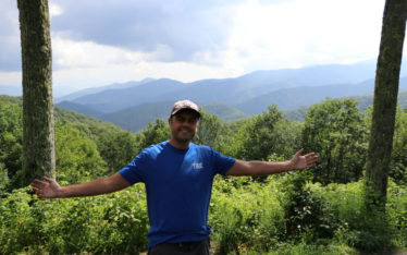
The first half mile or so of the trail took us over relatively flat ground to a small lake known as “Cold Boiling Lake”. This was a unique feature as the lake appeared to be “boiling” as there was an area that was bubbling up, but the lake was cold as we were at a relatively high altitude. From the lake the 2 miles on the trail to Bumpass Hell was either amazing or terrifying depending if you spoke to Julie or myself. The trail started to go up in elevation first cutting through the forest then it was carved into the side of a relatively steep hill. Parts of the trail were actually part of a creek, so you had to be careful to make sure to step on the big rocks and not slip and fall to your left. This was a situation where you’re not going to fall off a cliff if you fell but, you would roll or slide for a way before being able to stop yourself. For me the hike was incredible. The higher we went, the better the views got. The path slowly went up and up, every so often cutting through a bit of forest on the side of the mountain then out into a grassy area again. Julie was having a bit of trouble as she does not do as well with heights as I do. She needed to go slowly which I was fine with as I loved looking at the views from the trail.
Eventually we made it to Bumpass Hell. As the only way to get to this part of the park was on the 5-mile round-trip trail, what normally would have been one of the most crowded parts of the park was now virtually empty. Bumpass Hell is a 16-acre bowl filled with mud pots, bubbling pools and roaring steam vents. Here’s a cool video from the NPS website so you can really see what it looks like. Click here -> Bumpass Hell. After taking a few minutes of rest where we ate a small snack and drank some water we wandered down into the bowl. As this is a geothermal area you had to stay on the boardwalk. We didn’t want to accidentally step on unstable ground, then fall in and burn our leg off. Bumpass Hell is named after Kendall Bumpass who did accidentally break the crust of the ground and burnt his leg very badly. There were only 2 or 3 people there so taking a few pictures to make it seem like we had the place to ourselves was not a problem at all.
The Sound of Music – National Park Style
After taking all the photos and videos that we wanted we decided to hit the trail again and head on down. About halfway to the Cold Boiling Lake in a section of the trail that was reminiscent of a meadow I convinced Julie to sing the Sound of Music. Julie’s voice is really amazing and it’s a talent that she keeps almost to herself so listening to her belt it out on the side of a mountain was awe inspiring. I hope someone else on the trail was able to hear it too. Eventually we made it down the mountain to Cold Boiling Lake and back to the van. Overall this might have been my all-time favorite hike in the past 2 ½ years. It was difficult but the views and seeing the geothermal area without many people there was 100% worth it. Once we got back in the van it was getting later in the day, so we headed back to our campground for the night.
The next day we packed up and headed back to the park. We would be spending the next few nights in Redding, CA but we would be able to spend most of the day in the park today. After entering the park today, we headed to the gift shop/camp store to get our normal postcards/magnet and as Julie loved this park, she bought a tee shirt as well. We then walked around the adjacent Manzanita Lake, walking through a few busloads of elementary school students on a field trip.
We then jumped into the van and headed down the park road stopping at a few small trails and lookouts before stopping for lunch at Summit Lake North. This was a small campground and picnic spot next to the alpine Summit Lake. After parking Julie and I immediately wished that we had camped here. Here we were about 8000 feet up having lunch next to a small crystal clear alpine lake. There were a few other campers there and one guy had brought a tube and was just relaxing in the lake. It looked like he was in a state of pure bliss. We hung out here for a while enjoying the lake scenery before moving on.
Lassen Peak
Our next stop for the day was the parking area for Lassen Peak itself. While the top of the mountain is over 10,000 feet the parking area isn’t that far below it. The road had climbed higher and higher, switch backing over itself again and again to gain elevation. At the very top we were even over the tree line! As Lassen receives over 30 feet of snow in the winter, we shouldn’t have been surprised to see a huge snow mound at the end of the parking lot or patches of snow still on the side of the mountain even though it was late August. If we had not gone on the long hike the day before we might attempt to take the trail to the top of Mt. Lassen but as the trail looked like it basically went straight up we decided to pass on this one and just took a few pictures from the trail head.
Forest Fighting Helicopters
We then drove down the other side of the mountain passing then stopping at a few amazing little blue and green lakes. The deep blues and greens of these lakes contrasted greatly with the browns of the mountain color next to them really making the colors pop. We did see one of the crazier things here. There were forest fires going on in the park and in the nearby wilderness areas. We could hear helicopters while at the last parking area, but we could not tell where they were coming from. Once we started going down the other side, we saw them. They were forest fire helicopters that were taking water from these lakes to dump on the forest fires. It was pretty neat to see them almost land on the lake water, then scoop up water with a device hanging under them then fly off. This was for sure not something that we see every day. We then continued down the other side as we had one more stop to make.
Sulphur Works
Sulphur Works is another famous geothermal area of the park and its most accessible. It is located directly off the side of the park road. This area just like Bumpass Hell had mud pots and steam vents. As it was directly off the side of the road there were quite a few people here taking pictures. After taking a few pictures ourselves and breathing in the sweet sulphur air (yes it really does have a rotten egg smell) we hopped in the van and headed down and out of the park.
Overall, we really enjoyed this park. For us it was a lot like other geographically isolated parks that we had been to; Big Bend in Texas or Redwood National & State Parks – also in Northern CA. There was no fighting for a parking spot or large groups going around. There was no noise here except for the sounds of the park and our own footsteps going down the path. It was awesome and we can’t wait to go back!
Next up…..We spend a few days in and around Redding, CA!